 Valley of Fire Tours
Valley of Fire Map: Every Stop, Road and Trailhead
Most versions of a Valley of Fire map show you the roads and leave you to guess the rest. This one pins every stop with the thing you actually need before you set off: how far you walk from the car, whether the trail is open in the month you are visiting, and which of the guided tours from Las Vegas stops there. Coordinates were checked against OpenStreetMap in August 2026.
Quick answer
The park has two entrances and two roads worth driving. Valley of Fire Highway runs east to west between the entrances and carries most of the landmarks; Mouse's Tank Road branches north from the visitor centre and carries the trails, ending at White Domes after about six miles. Entry is $15 per vehicle for out-of-state visitors and $10 for Nevada-registered ones. There is no fuel and patchy signal inside the park.
Key takeaways
- West entrance: Interstate 15 exit 75, about 50 miles from the Strip. East entrance: Overton on NV-169
- Mouse's Tank Road holds Fire Wave, White Domes, Rainbow Vista and Pink Canyon, and three of those close every summer
- The visitor centre at 36.42999, -114.51377 is the last water and the last restroom with plumbing
- Download offline maps before you leave the freeway; coverage on the park roads is unreliable. Valley of Fire tours from Las Vegas handle the driving for you
- Every guided tour from Las Vegas drives the highway, but only the half-day trip and the guided hike reach the far end of Mouse's Tank Road
Every Stop in Valley of Fire, Mapped Against the Tours
Each bubble is a stop; its size shows how many of the eight guided Valley of Fire tours actually stop there. Click one for the walk length, the season and the tours that reach it. Type in the filter to narrow the map, for example sunset, lunch, hike or petroglyphs. Coordinates verified against OpenStreetMap in August 2026.
The 19 Stops, and Which Tours Reach Them
Sorted the way you meet them driving in from the west. Two operators do not publish a stop list, so the photo tour and part of the museum day are not counted here.
-
Beehives
2 of the toursCross-bedded sandstone domes ten minutes inside the west entrance, and the first thing most visitors photograph.
Stops here: Half day, $99, Full day, $129
-
Atlatl Rock
3 of the toursThe park's densest petroglyph panel, reached by a steel staircase bolted to the rock. Shaded under an overhang for most of the day.
Stops here: Half day, $99, Full day, $129, Multilingual, $109
-
Arch Rock
No tourA thin natural arch in the campground loop, visible from the road and unaffected by the summer trail closure.
No guided tour stops here. Self-drive only.
-
Petrified Logs
1 of the toursFossilised wood washed into the valley and now fenced in place on a short loop off the highway.
Stops here: Multilingual, $109
-
Atlatl Rock Campground
No tourFirst-come camping with showers and flush toilets. $25 per vehicle per night out of state, $20 with Nevada plates.
No guided tour stops here. Self-drive only.
-
Arch Rock Campground
No tourThe more basic of the two campgrounds; 72 sites between them, some with utility hookups for $10 more.
No guided tour stops here. Self-drive only.
-
Visitor Centre
3 of the toursExhibits, paper maps, the only plumbed restrooms and the only water for sale in the park. Opens 9 a.m., closes 4 p.m.
Stops here: Half day, $99, Full day, $129, Multilingual, $109
-
Seven Sisters
2 of the toursFreestanding sandstone columns with picnic ramadas underneath, and the only shaded tables on the standard route.
Stops here: Half day, $99, Full day, $129
-
Historic Cabins
1 of the toursThree sandstone shelters built by the Civilian Conservation Corps in the 1930s for travellers crossing the valley.
Stops here: Sunrise + Red Rock, $148
-
Elephant Rock
4 of the toursAn arch shaped like a trunk and head, the shortest walk to a landmark in the park, right by the east entrance.
Stops here: Half day, $99, Full day, $129, Sunrise + Red Rock, $148, Guided hike, $129
-
Mouse's Tank
1 of the toursA sandy wash lined with unmarked Ancestral Puebloan petroglyph panels, ending at a natural basin that holds rainwater.
Stops here: Guided hike, $129
-
Rainbow Vista
5 of the toursA flat mile to a panorama over banded sandstone. Washed out at noon, and the best view in the park an hour before sunset.
Stops here: Half day, $99, Full day, $129, Sunrise + Red Rock, $148, Sunset, $128, Guided hike, $129
-
Fire Canyon overlook
2 of the toursRed and white canyon walls off the Fire Canyon spur road, with a tight turning circle at the end.
Stops here: Half day, $99, Full day, $129
-
Silica Dome
No tourA pale dome of near-white sandstone at the end of the spur, the colour contrast that gives Fire Canyon its name.
No guided tour stops here. Self-drive only.
-
Fire Wave
3 of the toursThe striped sheet of sandstone the park is known for, 1.5 miles round trip with 236 feet of climb over soft sand.
Stops here: Half day, $99, Full day, $129, Guided hike, $129
-
Pink Canyon
No tourA narrow pastel-walled wash off White Domes Road, reached in 0.4 miles from a handful of roadside spaces.
No guided tour stops here. Self-drive only.
-
White Domes
1 of the toursA 1.1-mile loop with a slot canyon and the sandstone remains of a 1965 film set, at the end of the road.
Stops here: Guided hike, $129
-
East entrance
No tourThe Overton end of the park on NV-169, closest to Elephant Rock and to Lake Mead.
No guided tour stops here. Self-drive only.
-
Lost City Museum, Overton
1 of the toursAncestral Puebloan material excavated before Lake Mead flooded the settlements it came from. Outside the park, own admission.
Stops here: Lost City Museum, $161
How the Park Is Laid Out
Two entrances, and which one to use
Valley of Fire Highway runs the width of the park between two fee booths. The west entrance sits closest to Las Vegas, reached by taking Interstate 15 north to exit 75 and turning east. The east entrance is on NV-169 near Overton and is the one to use if you are coming from Lake Mead or heading on to the Lost City Museum.
Most visitors from Las Vegas enter west and leave the same way. Entering west also means you meet the landmarks in the order most guides describe them, starting with the Beehives.
The road that holds the trails
Mouse's Tank Road, which becomes White Domes Road, branches north from the visitor centre and runs about six miles to a loop at the end. Everything people walk to is on it: Mouse's Tank, Rainbow Vista, the Fire Canyon spur, Fire Wave, Pink Canyon and White Domes.
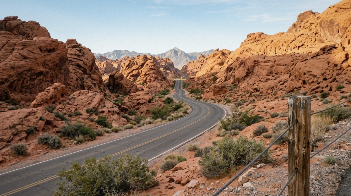
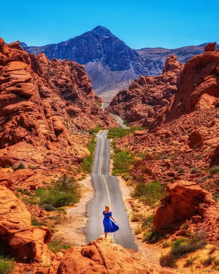
It is also the most photographed road in Nevada, a two-lane ribbon dipping between red walls. The pull-outs are small and unmarked; if you stop for the view, get the car fully off the pavement.
What is not on the map
There is no fuel, no shop and no restaurant inside the park. The visitor centre sells water and has the only plumbed restrooms; everything else is a vault toilet. Nothing loose in your pockets when you use one, as a reviewer of one of the tours learned.
The last services before the park are at the Moapa exit on Interstate 15 or in Overton. Getting there in detail is covered in our guide to reaching the park.
The Pins Explained
Parking, walking distance and season
The practical version of the map. Walk distances are round trip from the nearest car park.
| Stop | Road | Parking | Walk | Season |
|---|---|---|---|---|
| Beehives | Valley of Fire Highway | Pull-out | Roadside | All year |
| Atlatl Rock | Campground loop | Small lot | Stairs | All year |
| Petrified Logs | Valley of Fire Highway | Small lot | 0.2 miles | All year |
| Visitor centre | Valley of Fire Highway | Large lot | Roadside | 9 a.m. to 4 p.m. |
| Seven Sisters | Valley of Fire Highway | Pull-out | Roadside | All year |
| Historic Cabins | Valley of Fire Highway | Pull-out | Roadside | All year |
| Elephant Rock | East entrance | Lot at the gate | 0.3 miles | All year |
| Mouse's Tank | Mouse's Tank Road | Medium lot | 0.75 miles | All year |
| Rainbow Vista | Mouse's Tank Road | Medium lot | 1 mile | All year |
| Fire Canyon overlook | Fire Canyon spur | Small lot | Roadside | All year |
| Fire Wave | White Domes Road, lot P3 | Small lot, fills first | 1.5 miles | Closed May 15 to September 30 |
| Pink Canyon | White Domes Road | Roadside, few spaces | 0.4 miles | Closed May 15 to September 30 |
| White Domes | End of White Domes Road | Loop lot | 1.1 miles | Closed May 15 to September 30 |
Where parking runs out
Three car parks fill before the others: lot P3 at the Fire Wave trailhead, the White Domes loop at the end of the road, and the handful of roadside spaces at Pink Canyon. All three are on the same stretch, and all three are busiest between 10 a.m. and 2 p.m. on weekends from October to April.
The fix is to drive to the end of the road first and work backwards, which is the opposite of what most visitors do.
Driving Times, Inside and Out
What the distances actually are
The park is compact. Almost all the time in a day here goes on walking and stopping rather than driving.
| Leg | Distance | Time |
|---|---|---|
| Las Vegas Strip to the west entrance | About 50 miles | 55 to 65 minutes |
| West entrance to the visitor centre | About 6 miles | 10 minutes |
| Visitor centre to the end of White Domes Road | About 6 miles | 12 minutes |
| West entrance to east entrance, no stops | About 11 miles | 20 to 30 minutes |
| East entrance to Overton | About 8 miles | 12 minutes |
| East entrance to Lost City Museum | About 12 miles | 18 minutes |
Offline maps and signal
Coverage holds along the highway near the entrances and drops on Mouse's Tank Road and around White Domes. Navigation apps stop updating exactly where the side roads start, so download the area for offline use before you leave Interstate 15.
The park hands out a paper map at the fee booth and at the visitor centre. It is worth taking even if your phone is working, because it names formations the apps do not.
Which Tour Covers Which Part of the Map
Coverage by trip
Every guided trip drives Valley of Fire Highway. The difference is how far up Mouse's Tank Road they go and whether they walk once they get there.
| Tour | Highway stops | Mouse's Tank Road | Off-map extras |
|---|---|---|---|
| Half day, $99 | Beehives, Atlatl Rock, Seven Sisters, Elephant Rock, visitor centre | Rainbow Vista, Fire Canyon, Fire Wave | None |
| Full day, $129 | Same eight stops, longer at each | Rainbow Vista, Fire Canyon, Fire Wave | None |
| Guided hike, $129 | Varies with the route chosen | White Domes, Mouse's Tank, Fire Wave | Off-trail arches and panels |
| Sunset, $128 | Selected stops in the afternoon | Rainbow Vista at sunset | None |
| Sunrise plus Red Rock, $148 | Elephant Rock, the Cabins | Rainbow Vista, two unnamed spots | Red Rock Canyon, 40 minutes |
| Lost City Museum day, $160.99 | Selected stops, about 3 hours | Not stated | Lost City Museum, Overton |
The parts no tour reaches
Prospect Trail, Arrowhead Trail, Charlie's Spring and Pinnacles Loop appear on the park's paper map and on no tour itinerary. They are long, poorly marked and closed all summer, which is why. If they are what you came for, you are driving yourself and starting early.
For everything else, the eight trips are compared side by side on our Valley of Fire tours from Las Vegas page, and the stop-by-stop detail is in our things to do guide.
Reading the Park From the Road
What the landmarks tell you about where you are
The park has no street signs and few landmarks that repeat, which is why visitors describe getting turned around despite there being only two roads. The reliable markers are geological.
Beehives mean you are near the west entrance. Seven Sisters, a line of freestanding columns beside the highway, means you are east of the visitor centre. The Cabins mean you are close to the east gate. On Mouse's Tank Road, the landscape opens out at Rainbow Vista and narrows again before White Domes, so the widest view on that road is roughly its midpoint.
Where the road surface changes
Valley of Fire Highway and Mouse's Tank Road are paved and maintained. The Fire Canyon spur is paved but narrow with a tight turning circle at the end, awkward for anything longer than a van.
Everything else on the paper map that looks like a road is either a wash or an old mining track, and neither is passable in a rental. If your navigation app suggests a shortcut between the two roads, it is proposing a wash.
After rain
Flash flooding closes road sections here occasionally, most often in July and August when storms arrive fast and drain across the pavement rather than under it. The park closes affected stretches for a day or two and reopens them once the sand has been cleared.
The practical rule is the same as anywhere in the desert: do not drive into standing water, and do not park in a wash to photograph a storm.
Questions About the Park Layout
Can you just drive through Valley of Fire?
Yes. The highway crosses the park between the two entrances in 20 to 30 minutes without stops, and you still pay the $15 vehicle fee. You would miss every trail and most of the formations, all of which sit a short walk off the road.
How long is the drive through Valley of Fire?
About 11 miles between the west and east entrances on Valley of Fire Highway, which takes 20 to 30 minutes at the posted limits. Mouse's Tank Road adds another six miles north to the White Domes loop, or about 12 minutes each way.
Where is the visitor centre and what is there?
At 36.42999, -114.51377, roughly in the middle of the park on Valley of Fire Highway. Geology and human-history exhibits, water, the only plumbed restrooms, and paper maps. It opens at 9 a.m. and closes at 4 p.m., which catches out anyone arriving for sunrise or staying for sunset.
Which road has the best scenery?
Mouse's Tank Road. It leaves the visitor centre, drops between red walls and ends at White Domes, and it holds Fire Wave, Rainbow Vista and Pink Canyon along the way. Valley of Fire Highway carries more named landmarks but less continuous drama.
Is there phone signal in the park?
Patchy. It generally holds near the entrances and the visitor centre and fails along Mouse's Tank Road and at White Domes. Download offline maps before you leave the freeway and do not rely on live navigation once you are inside.
Why is Valley of Fire closed sometimes?
The park itself stays open sunrise to sunset all year. What closes are specific trails, from May 15 through September 30, because of heat-related rescues and deaths. Occasional flash flooding also shuts sections of road for a day or two after heavy rain.
Print the paper map at the fee booth, drive to the far end of Mouse's Tank Road first, and work back toward the entrance. That one change beats every routing tip on this page.